4 Jun 2026
Post by usertopnews
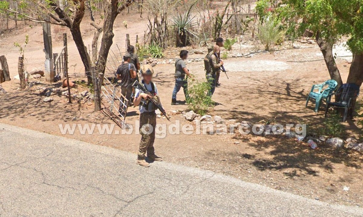
On Thursday, June 4, 2026, an unusual encounter was documented by a Google Street View vehicle while driving through a rural stretch in Culiacán, Sinaloa. The vehicle, responsible for capturing panoramic street-level images, unexpectedly came face-to-face with a group of armed men identified as sicarios from the Jalisco New Generation Cartel (CJNG).
The incident took place on the road connecting the communities of El Tepuche and Los Algodones. As the driver rounded a curve, he encountered an improvised checkpoint manned by several armed individuals who signaled him to slow down and stop. With the Google-branded vehicle and cameras clearly visible, the driver complied.
Images uploaded to Google Maps at coordinates 25°00’44.9″N 107°19’33.5″W show the driver engaging in a brief conversation with three of the armed men. After a few moments, the vehicle was allowed to continue its route. However, the sequence also captures three additional armed men approaching, seemingly drawn by curiosity about the camera equipment and the vehicle’s markings. The final shot shows one of the gunmen watching the car until it disappears from view.
This rare visual documentation highlights the complex realities of control and influence that criminal groups exert over certain secondary roads and rural areas in Mexico. While such images are incidental, they offer a stark glimpse into the challenges of security and mobility in regions affected by organized crime.
For migrants and residents navigating life in Mexico, understanding these dynamics is crucial. Infrastructure projects like Puebla’s upcoming cable car system, designed to improve safe and efficient urban transit, contrast sharply with the insecurity found on some rural routes. These initiatives represent steps toward inclusive, state-supported solutions that prioritize public safety and accessibility.

1 comentario